Marine Spatial Planning

Ecosystem-based Marine Spatial Planning for a Sustainable Blue Economy

marisma-logo

“The process of MSP is new and just a few years ago was completely unknown in the region. Today, thanks to the ongoing support of the MARISMA project, the contracting parties of the Benguela Current Convention, Angola, Namibia and South Africa, are globally acclaimed for their progress in using MSP to enhance their Blue Economy. We are proud to have come so far and look forward to continuing this successful partnership.”

Thandiwe GXABA, Acting Executive Secretary of the Benguela Current Convention

Diamond Coast (Xenia Ivanoff-Erb)
© Xenia-Ivanoff-Erb
Cape Fur Seals (Xenia Ivanoff-Erb)
© Xenia-Ivanoff-Erb
Walvis Bay Harbour (Xenia Ivanoff-Erb)
@ Xenia-Ivanoff-Erb
© Xenia-Ivanoff-Erb
Walvis Bay Harbour Tours (Xenia Ivanoff-Erb)
© Xenia-Ivanoff-Erb
Walvis Bay Fishing Industry (Xenia Ivanoff-Erb)
© Xenia-Ivanoff-Erb
Skeleton Coast (Xenia Ivanoff-Erb)
© Xenia-Ivanoff-Erb
Salt Pans (Xenia Ivanoff-Erb)
© Xenia-Ivanoff-Erb
Pelican Point Unnamed Wreck (Xenia Ivanoff-Erb)
© Xenia-Ivanoff-Erb
Pelican Bay (Xenia Ivanoff-Erb)
© Xenia-Ivanoff-Erb
NAMPORT (Xenia Ivanoff-Erb)
© Xenia-Ivanoff-Erb
Fisherman (Xenia Ivanoff-Erb)
© Xenia-Ivanoff-Erb
previous arrow
next arrow

Project

The introduction of ecosystem-based MSP in the BCLME is supported by the Benguela Current Marine Spatial Management and Governance Project (MARISMA, 2014-2023). The project is a development partnership between the BCC, its Contracting Parties, and the Government of the Federal Republic of Germany in pursuit of the sustainable development of the Benguela Current region. This regional capacity-building and development cooperation project is implemented by the BCC, the Governments of Angola, Namibia and South Africa, and GIZ, the German Agency for Development Cooperation (Deutsche Gesellschaft für Internationale Zusammenarbeit (GIZ) GmbH). MARISMA is financed by the International Climate Initiative (IKI) of the German Federal Ministry for the Environment, Nature Conservation, Nuclear Safety and Consumer Protection (BMUV). The BMUV supports this initiative on the basis of a decision adopted by the German Bundestag (Parliament) with up to 11,680 Million. €. Significant in-kind contributions by the BCC and its three member countries complement the German financing.

FactsheetMarine Spatial Planning in South AfricaMarine Spatial Planning in Namibia

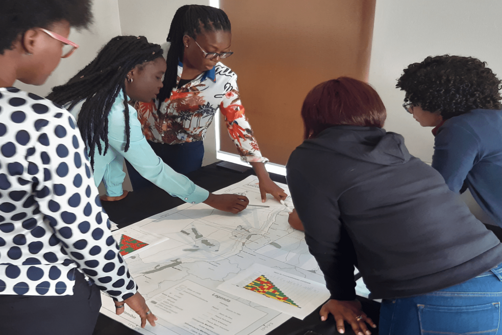
Like many other countries sharing Large Marine Ecosystems (LMEs) where user-user and user-environment conflicts are growing, the three governments of Angola, Namibia and South Africa have recognised the need to introduce Marine Spatial Planning (MSP).

The aim is to use the MSP process to organise the development of the marine area by ordering multiple claims in space and time, based on the best available evidence and arrived at through political prioritisation.
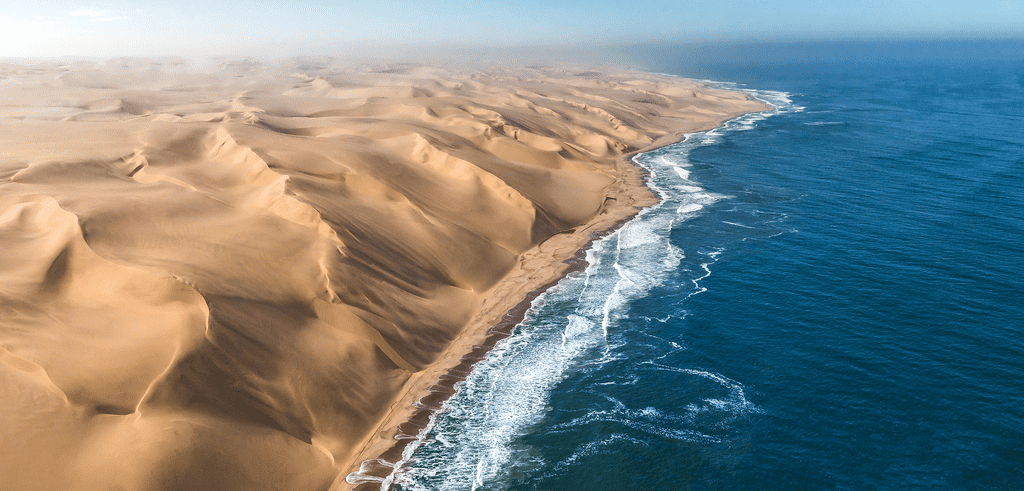
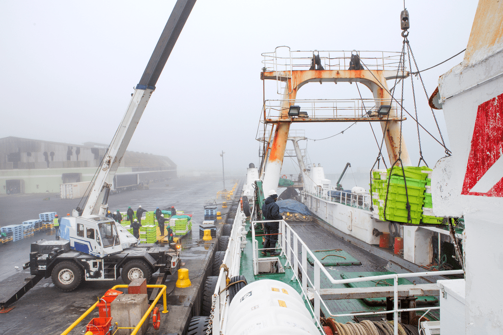
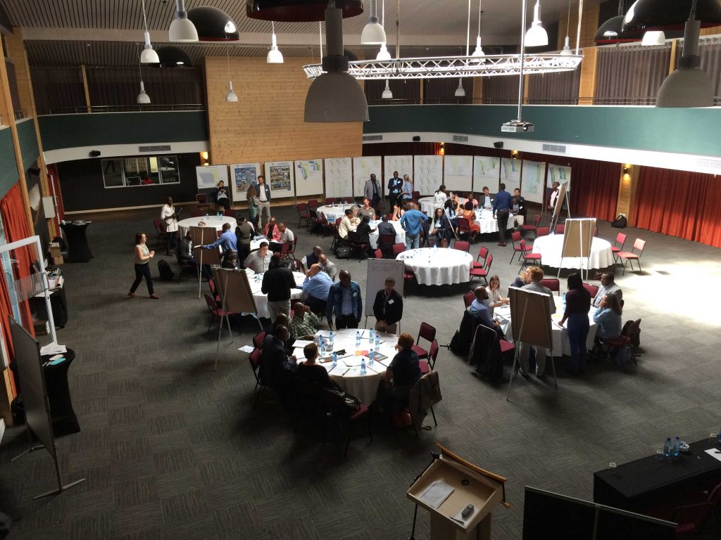
© GIZ

MSP is considered as the preferred pathway to enable an integrated approach to marine management which starts with a participatory decision-making process that guides where and when human activities occur in marine space. Much like planning on land, the principal outputs of MSP are comprehensive spatial management and development plans for marine areas of the BCLME. As such, MSP is seen as a necessary first step and an important precondition for sustainable ocean development both at the national and wider regional level.

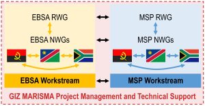
The introduction of MSP is driven by socio-economic and ecological goals: On the one hand, MSP is promoted as a mechanism that provides the spatial foundation for the growth of sustainable blue/ocean economies. In addition to this socio-economic interest in MSP, the BCC countries also recognised the contribution MSP can make to implementing the ecosystem approach. In line with national and international biodiversity conservation targets, the BCC countries aligned their respective MSP processes with a systematic conservation planning process that focuses on the countries’ most valuable natural sites, the so-called Ecologically or Biologically Significant Marine Areas (EBSAs). Knowing where EBSAs are and how they need to be managed so that their special ecological properties can be maintained informs the MSP processes and contributes to safeguarding ocean health.
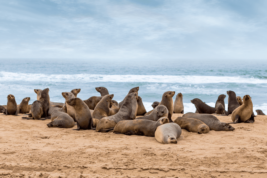
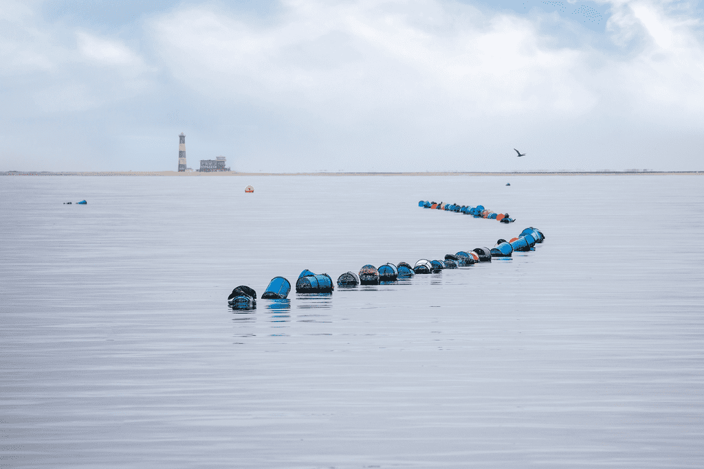
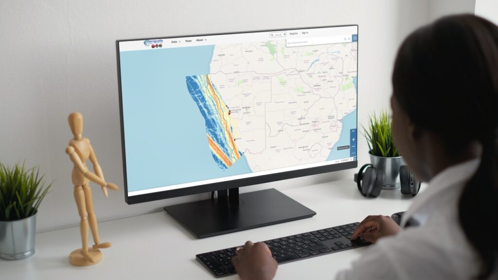
© Xenia Ivanoff-Erb


MSP in the region is therefore considered ecosystem-based in that it integrates conservation interests and socio-economic development. In that sense, MSP is used as an approach to optimise opportunities for sustainable blue growth while maintaining a healthy resource base for the future.

Serving economic, social, governance, and ecological objectives, MSP in the region clearly links conservation agendas and socio-economic development needs in the context of a sustainable blue/ocean economy. Development of capacities, institutionalisation of processes as standard operating procedures, stakeholder engagement, as well as learning and cooperation across sectors and borders are critical elements of the region’s approach to MSP.

English

isiXhosa

Portuguese

isiZulu

Afrikaans

At BCC level, two Regional Working Groups (RWGs) have been established (one on MSP and the other on Ecologically or Biologically Significant Marine Areas, EBSAs) to support the initiation of MSP at national levels by enabling the exchange of the growing experiences and knowledge on MSP across the three countries. The idea of learning from and with each other at the early stages of the national-level MSP processes has not only enabled intra-regional capacity development but also contributed to similar approaches across the countries.

The EBSA RWG has ensured a coordinated and coherent approach to the identification and management of the region’s most valuable marine sites. This has resulted in the addition of 12 new EBSAs and the updating of 16 existing EBSA descriptions. These EBSAs were then approved politically at the national and ministerial levels for submission to the Convention on Biological Diversity in 2020 (Namibia and South Africa) and 2021 (Angola) – making the countries among the first worldwide to have submitted new/updated EBSAs.

In terms of MSP, all countries have divided their marine areas into several distinct planning areas based on human uses and ecological boundaries. The countries have compiled strategic elements for their national MSP processes. The frameworks provide high-level guidance for preparing and approving marine plans, as well as implementation, monitoring and review them.

© GIZ

Sound knowledge and evidence baselines were established. These knowledge baseline reports are assessments that outline the current conditions and human uses, likely future developments, and the concerns that MSPs, and particularly the marine spatial plans, need to (and can) solve.

Based on the baseline reports marine plans have since been developed in the countries. While South Africa has already established a legal framework for MSP, Namibia and Angola are in the process of legislating for MSP. In all three countries, national policies (Blue Economy policy in Namibia), strategies (Ocean Strategy in Angola), or initiatives (Operation Phakisa in South Africa) provide the framing for MSP in the context of sustainable ocean development agendas.

© Harris et al., 2022


To further direct users in implementing the plans, guidelines for plan implementation, as well as monitoring and evaluation strategies, have been developed.

In 2018, a regional MSP strategy has been developed and adopted at the BCC level. The strategy is advisory in nature, with the aim of facilitating a coherent and consistent approach to MSP across the three countries. The strategy suggests similar MSP processes that all three countries should consider when implementing MSP, such as stakeholder engagement or a 7-10-years plan review period.

Future priorities are the development of further marine spatial plans, the legislation of MSP and plan implementation.


The MSP processes at national levels and regionally have resulted in a number of products:

Product
South Africa – MSP Act (2019)
South Africa
South Africa – EBSA Submission (2020)
South Africa
South Africa – National Biodiversity Assessment 2018 Vol 4 Marine (2019)
South Africa
South Africa – National Data and Information Report (2021)
South Africa
South Africa – National Framework for MSP (2021)
South Africa
South Africa – National Coastal and Marine Spatial Biodiversity Plan Factsheet (2022)
South Africa
South Africa – National Coastal and Marine Spatial Biodiversity Plan Technical summary (2022)
South Africa
South Africa – National Coastal and Marine Spatial Biodiversity Plan Technical report (2022)
South Africa
Angola – EBSA Submission English (2020)
Angola
Angola – Relatório Preliminar sobre o Ordenamento do Espaço Marinho em Angola (2020)
Angola
Angola – EBSA Submission Portuguese (2020)
Angola
Angola – Estratégia Nacional para o Mar de Angola, ENMA (2022)
Angola
Namibia – EBSA Submission (2020)
Namibia
Namibia – Current Status Report 2nd Edition (2021)
Namibia
BCC – Regional Spatial Biodiversity Assessment (2014)
BCC
BCC – EBSA Posters (2022)
BCC
BCC – Regional MSP Strategy (2018)
BCC

    A number of articles have been published in scientific journals and as book chapter. These capture and analyze the processes and results.

    • Harris, L.R., Holness, S.D., Finke, G., Amunyela, M., Braby, R., Coelho, N., Gee, K., Kirkman, S.P., Kreiner, A., Mausolf, E., Majiedt, P., Maletzky, E., Nsingi, K.K., Russo, V., Sink, K.J. and Sorgenfrei, R., 2022. Practical Marine Spatial Management of Ecologically or Biologically Significant Marine Areas: Emerging Lessons From Evidence-Based Planning and Implementation in a Developing-World Context. Frontiers in Marine Science 9: 831678. (https://doi.org/10.3389/fmars.2022.831678)
    • Finke, G., Gee, K., Kreiner, A., Amunyela, M. & Braby, R., 2020. Namibia’s way to Marine Spatial Planning – Using existing practices or instigating its own approach? Marine Policy 121, 104107. (https://doi.org/10.1016/j.marpol.2020.104107)
    • Finke, G., Gee, K., Gxaba, T., Sorgenfrei, R., Russo, V., Pinto, D., Nsiangango, S.E., Sousa, L.N., Braby, R., Alves, F.L., Heinrichs, B., Kreiner, A., Amunyela, M., Popose, G., Ramakulukusha, M., Naidoo, A., Mausolf, E. & Nsingi, K.K., 2020. Marine Spatial Planning in the Benguela Current Large Marine Ecosystem. Environmental Development 36, 100569. (https://doi.org/10.1016/j.envdev.2020.100569)
    • Harris, L.R., Holness, S., Finke, G., Kirkman, S. & Sink, K., 2019. Systematic Conservation Planning as a Tool to Advance Ecologically or Biologically Significant Area and Marine Spatial Planning Processes, In Maritime Spatial Planning. eds J. Zaucha, K. Gee. Palgrave Macmillian, Cham. (https://doi.org/10.1007/978-3-319-98696-8_4)
    • Kirkman, S.P., Holness, S., Harris, L.R., Sink, K.J., Lombard, A.T., Kainge, P., Majiedt, P., Nsiangango, S.E., Nsingi, K.K. & Samaai, T., 2019. Using Systematic Conservation Planning to support Marine Spatial Planning and achieve marine protection targets in the transboundary Benguela Ecosystem. Ocean & Coastal Management 168, 117-129.
    • Harris, L.R., Bessinger, M., Dayaram, A., Holness, S., Kirkman, S., Livingstone, T.-C., Lombard, A.T., Lück-Vogel, M., Pfaff, M., Sink, K.J., Skowno, A.L., Van Niekerk, L., 2019. Advancing land-sea integration for ecologically meaningful coastal conservation and management. Biological Conservation 237, 81-89

    The two RWGs on MSP and EBSAs have identified the need for a joint spatial data repository to facilitate cross-border coordination and sharing of data and information. To meet this need the BCC GeoData Portal has been developed to host (Angola and Namibia) or to link (South Africa) relevant spatial data, not only for the MSP and EBSA processes. The portal is an online digital platform that stores and provides access to geospatial information (and related documents) on the marine environment and human uses in the BCLME. Its two primary objectives are:

    (1) to support integrated ocean governance on the regional and national levels,

    (2) to support access and sharing of spatial data of the BCC contracting parties.

    Its contents are directed towards organizations and professionals with responsibilities for conducting analyses, providing advice and/or making decisions on the governance and management of the marine environment at the regional, sub-regional and national levels. In South Africa, the National Oceans and Coastal Information Management System (OCIMS) Marine Spatial Planning (MSP) Decision Support Tool provides consolidated view of data sources that can inform MSP.

    Project Partners

    Implemented by: German Agency for Development Cooperation (GIZ) in partnership with the BCC
    Duration: August 2014 – 31 December 2023
    Funding: Up to €11,680,000 (German contribution) with in-kind contributions by the BCC and its contracting states